The Best Satellite Images of Earth
Discover the Wonders of Our Blue Planet
From high above the Earth’s atmosphere, satellites capture breathtaking images of our beautiful planet, offering us an extraordinary perspective on its diverse landscapes and mesmerizing features. These images, more than just awe-inspiring, provide invaluable scientific data and contribute immensely to our understanding of Earth and its dynamic nature. Let’s embark on a fascinating journey through some of the best satellite images ever taken, showcasing the marvels of our home.
The Green Paradise: The Amazon Rainforest
Behold the lush emerald green canopy of the Amazon Rainforest, spanning thousands of miles across South America. In this vibrant oasis, every shade of green imaginable blends harmoniously, filling the image with life and vitality. The intricate network of rivers weaves through the dense vegetation, while sunlight peeks through the tree cover, creating nature’s masterpiece that sustains an incomparable variety of flora and fauna.
The Jewel of the Pacific: The Great Barrier Reef
Dive into a mesmerizing underwater realm captured by satellite above Australia’s east coast—the Great Barrier Reef, the epitome of breathtaking marine biodiversity. Vibrant coral formations create a kaleidoscope of colors contrasted against the deep blue of the surrounding ocean. This magnificent jewel harbors countless marine creatures, making it a truly remarkable sight that evokes both awe and an urge to protect this fragile ecosystem.
Sublime Serenity: The Sahara Desert
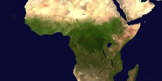
Vast, barren landscapes stretching beyond the horizon, the Sahara is a captivating testament to the serene beauty found even in desolation. In this satellite image, undulating dunes swirl in shades of burnt orange, occasionally interspersed with pieces of classic Saharan architecture. The velvet sky above serves as a reminder of the sheer expanse and tranquility of this spectacular desert.
The Frozen Wonderland: Antarctica
Explore the ethereal beauty of the world’s southernmost continent, Antarctica—a land of perpetual ice and glistening snow. From above, icy shelves extend into the frigid waters, and breathtaking glaciers calve into the sea. This awe-inspiring image captures the pristine majesty of a continent largely untouched by human presence, offering a hauntingly mesmerizing glimpse into our planet’s frozen wonderland.
A Marvelous Mosaic: The Himalayas
Marvel at the incredible Himalayan range that boasts majestic snowy peaks entwined with the tapestry of diverse cultures dotting its valleys. This satellite image captures the grandeur of the mighty mountains as if painted by divine hands. Snow-capped pinnacles reach for the skies, while sacred rivers powerfully traverse the colossal canyons below—this is a land where earthly and spiritual realms beautifully converge.
Celebrating Earth’s Diversity and Beauty
Together, these satellite images remind us of the exceptional and intricate beauty our planet holds. Every corner of Earth offers a unique and breathtaking spectacle that deserves our care, respect, and preservation.
 Mind Uncharted Explore. Discover. Learn.


